

Feldmaier Creek - Landscape
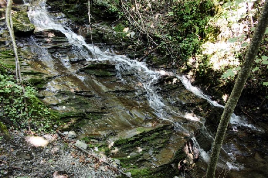
The small, steep Feldmaier creek, which
runs from the Feldmaier farm in the north
through the village of Pichl (794 m, west of
St. Veit) to its confluence with the Wenger
creek to the north-east of the Schernberg
Castle in the south, is a typical gorge-like
mountain creek.
From a geological point of view, the
Feldmaier creek is located in the area of
the greywacke zone.
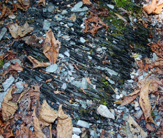
The creek is laid out in what are known as Wildschönauer slates (Upper Ordovician
to Devonian, 485 - 420 million years)
and runs through very fi nely divided and
extremely thin-fl aked, black phyllites here
in the Pichl area. Harder calcareous phyllite
layers can also be found to the north of
Pichl, which cross the creek bed almost at
right angles.
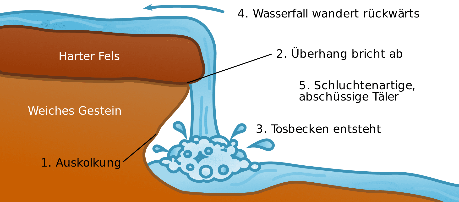
A small waterfall that falls from a height
of around 6 meters and has a gradient
of around 45° offers a special natural
spectacle. In the summer months
(especially when there is little rainfall),
the stream does not carry quite as much
water, but normally the water literally
“shoots” down the embankment. At about
670 m, the Feldmaier creek fl ows into the
Wengerbach creek in the deeply indented
gorge of the Putzengraben trench.
Kids
What are mass movements?
A mass movement is when a lot of earth, rocks or mud slide down a slope at once. This can happen when it rains heavily, the ground gets really wet and is then no longer solid but loosened up. Sometimes a lot of snow or an earthquake can also trigger such a mass movement. It's a bit like a big pile of earth suddenly starting to move and slide downhill. This can break roads, houses or trees because everything is pulled down with it.
What are mass movements?
A mass movement is when large quantities of earth, rocks or mud suddenly slide down a slope. This can happen when the ground becomes too wet due to heavy rain and thus unstable. Earthquakes or melting snow can also trigger such movements. These landslides can be very fast and sometimes carry away and damage roads, houses or forests. Mass movements are often very dangerous because they are difficult to predict and can cause major damage.
What are mass movements?
A mass movement occurs when large amounts of soil, rock or mud suddenly or gradually slide down a slope. These movements are often caused by external influences such as prolonged rain, which softens the ground and makes it unstable, or by events such as earthquakes, volcanic eruptions or melting snow. There are different types of mass movements, including landslides, mudslides and rockfalls. They can be very fast and destructive, especially in mountainous regions. Mass movements pose a danger because they occur without warning and can destroy roads, buildings and infrastructure. Human intervention, such as deforestation, often exacerbates the risk of mass movements. It is therefore important to respect nature and take protective measures to prevent such events or minimise their impact.
