

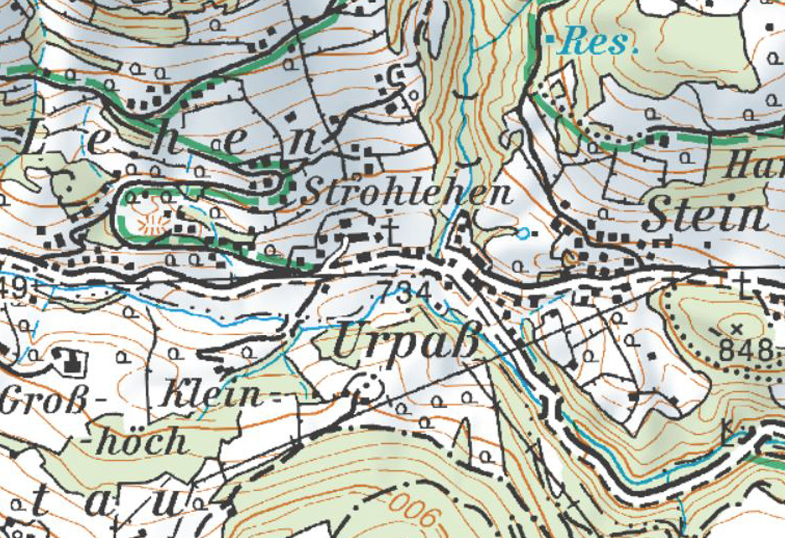
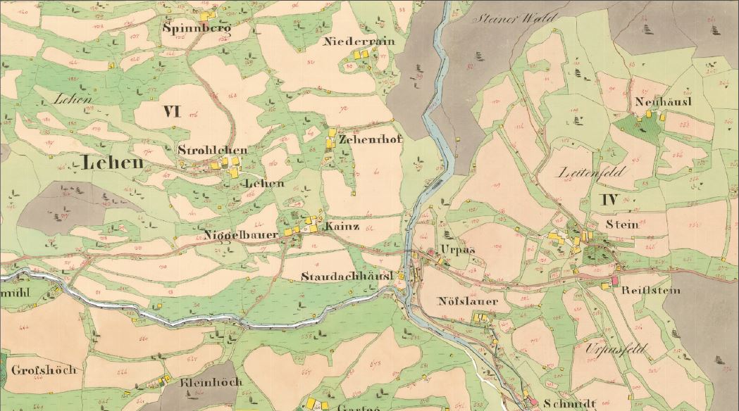
Raggl Creek - Landscape
The Raggl creek in the upper Putzengraben
trench, which consists of several channels
that rise east of the Schneeberg (1,921 m),
fl ows into the Wenger creek coming from
the west at Urpass (784 m). From the bend
in the river, where the direction of flow
changes from west/east to north/south,
i.e., east of the Klockeralm, the Raggl
creek forms a distinctive, deep gorge-like
trench.
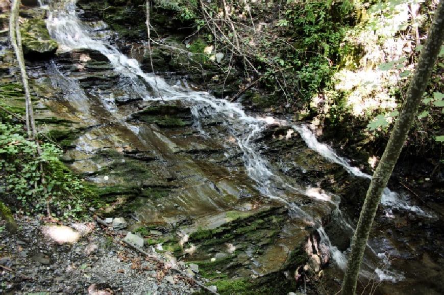
From a geological point of view, the
Raggl creek is located in the area of the
greywacke zone. The stream is created in
what is known as the Wildschönau slates
(Upper Ordovician to Devonian, approx.
485-420 million years) and runs through
an area of extremely fi nely divided and
very thin-leaved black phyllites here,
which are characterized by the fault zone
bordering to the northeast, to the much
harder limestone marble and calcareous
slates.
The lower Putzengraben trench has cut
deeply into its surroundings and runs,
gorge-like, towards the Salzach river with
a steep gradient. In this area, the creek
is already in the Schwarzach vicinity. The
Putzengraben trench posed a geotechnical
challenge when the St. Veit bypass road
was built.
Kids
Customs Krampus
There is a special tradition in Austria during the Advent season. During this time, dark fellows walk through the villages. The Krampus is a spooky figure with horns, fur and loud bells. He almost looks like a monster or a big devil.
The Krampus accompanies St Nicholas, who rewards the good children with sweets. The Krampus is there for the children who have not been so good. He is supposed to scare them so that they are better behaved next year. In many places, people dressed up as Krampus parade through the streets, making noise and carrying a rod. This is called the Krampus Run and is organised in many places in Salzburg. Many onlookers come to watch this spectacle.
Customs Krampus
In Austria, there is a special tradition during Advent where dark figures parade through the towns. The Krampus is a creepy figure with horns, fur and loud bells. He looks like a scary monster or a devil. The Krampus accompanies St Nicholas, who rewards the good children with sweets. The Krampus, on the other hand, is there for the children who have not been so good and is supposed to scare them a little so that they behave better next year.
In many places, especially in Salzburger Land, there are so-called Krampus runs. People dress up as Krampus, carry rods, make noise and run through the streets. Many spectators come together to witness this exciting and sometimes scary spectacle.
Customs Krampus
In Austria, there is an old tradition during Advent in which sinister figures, the so-called Krampus, parade through the villages and towns. The Krampus is a terrifying figure, often with horns, fur, a grim face and loud bells. He is reminiscent of a monster or a devil. The Krampus accompanies St Nicholas, who rewards good children with presents and sweets. But the Krampus is responsible for the naughty children - he is supposed to scare them and remind them to behave better next year.
In many regions, especially in Salzburger Land, there is the so-called Krampus run. Many people dress up as Krampus, wear chains, rods and masks and parade through the streets. These runs are spectacular and attract many onlookers. Although the Krampus run often looks spooky, it is an integral part of the Austrian Advent season and is an exciting experience for many.
